Filtering vector data
Filter tab
Sometimes you may want to hide some features by using indicators.
For example, only show where HDI is less than X value. In such case, filtering feature in GeoHub might be useful for you to visualize only focused features.
Add new filter rule
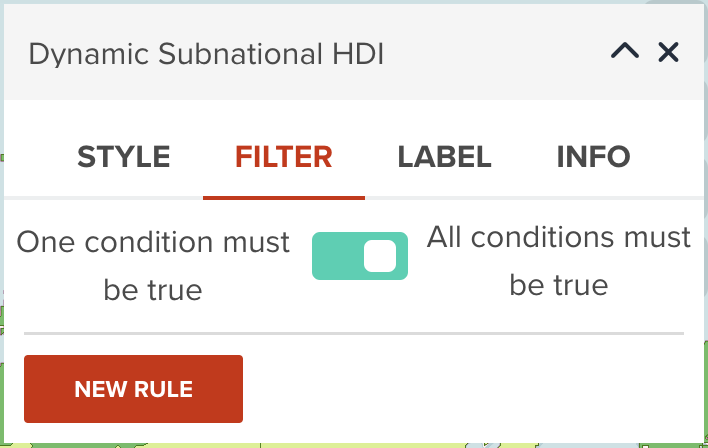
To use filtering, firstly please move to FILTER tab, then click NEW RULE button.
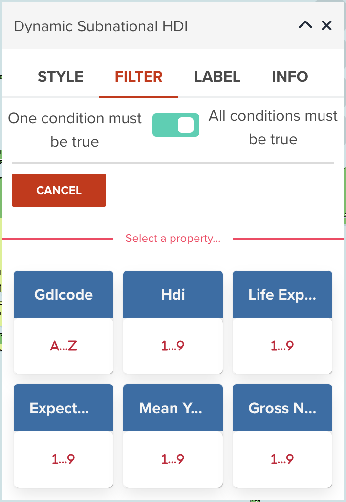
Select a property
Then, select a property you wish to filter by certain values.
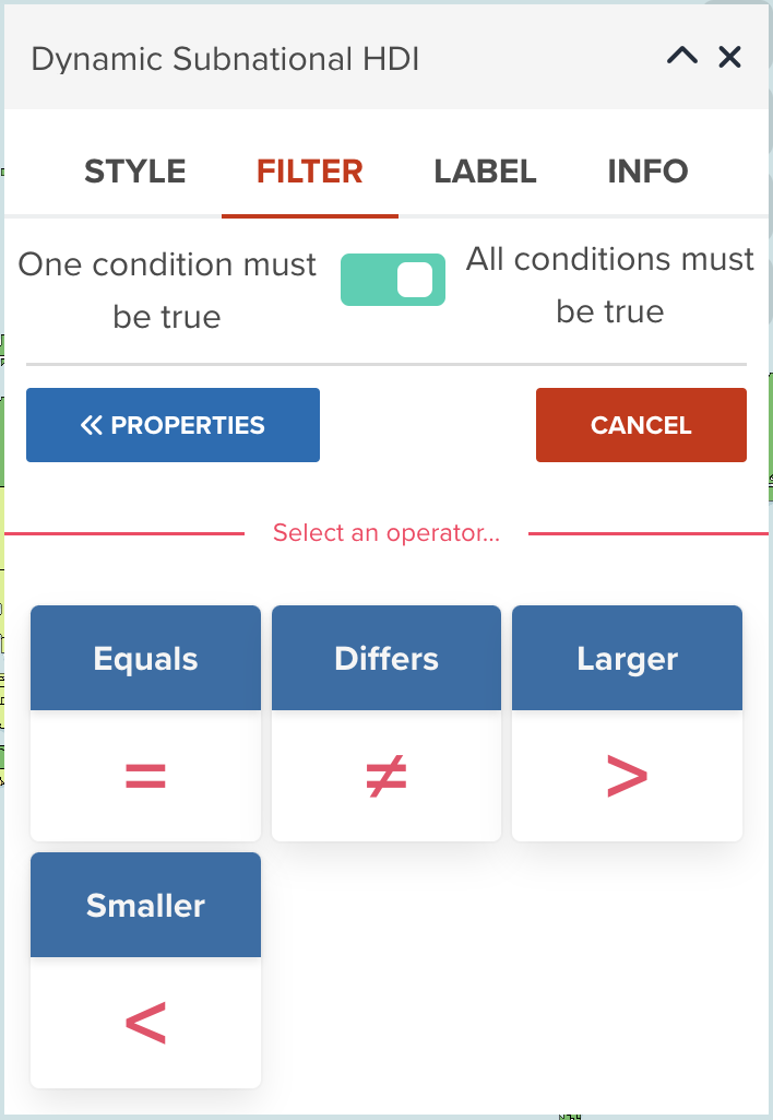
Choose an operator
After selecting a property, you need to choose what operator is used for filtering.
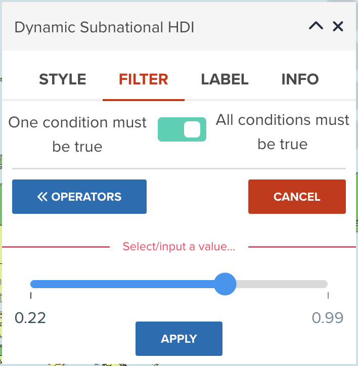
Choose a threshold to filter
After selecting a property and an operator, you need to select a value for filtering.
The user interface can vary according to the data type of selected property.
--
The below diagram is an example when you select a numeric field with Larger / Smaller operator. After selecting a value, click APPLY button. Your filtering rule will be applied to the map layer immediately.
Result after applying a filter
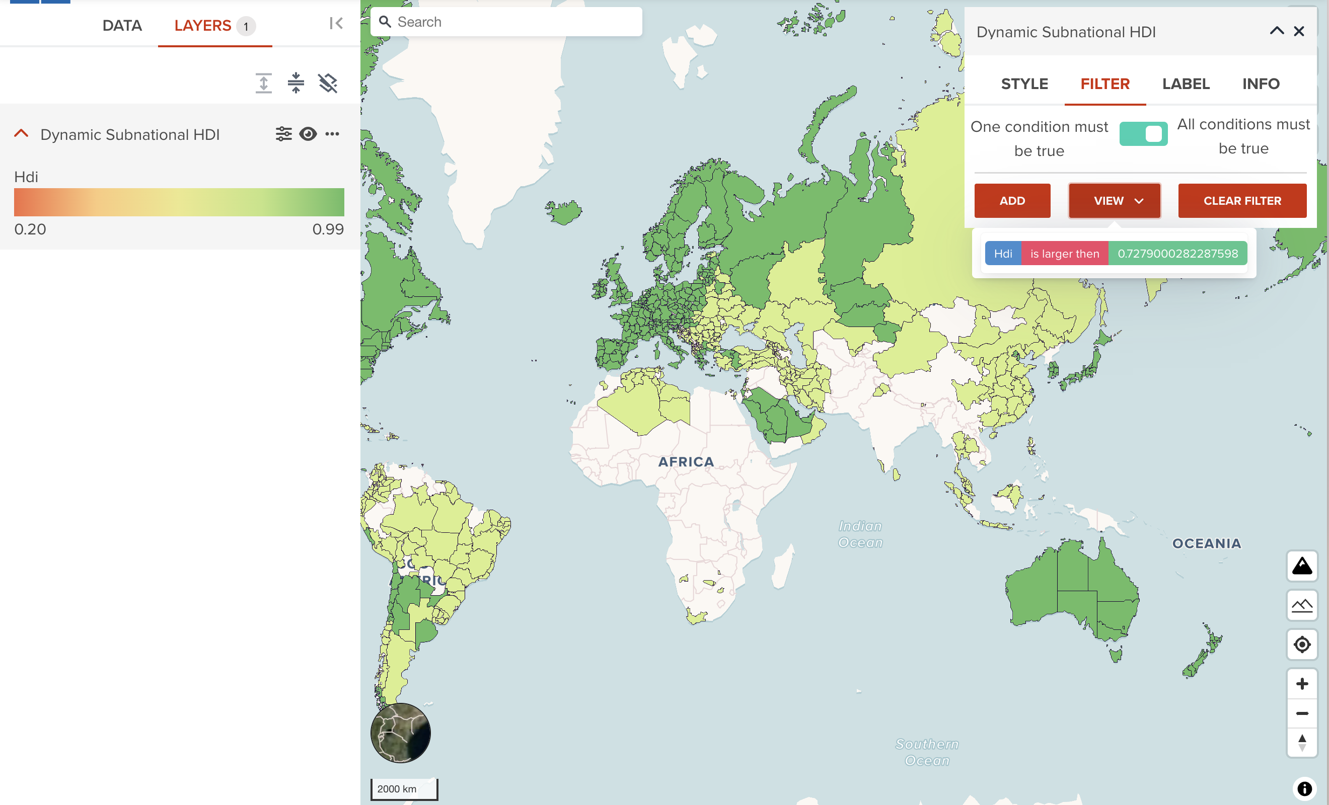
Continue adding or removing filter
You can continue adding another rule if you wish
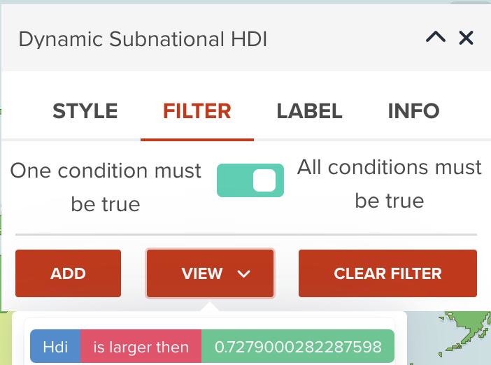
Note
When you add more than one rules to the layer, the toggle button on the top of FILTER tab might be important. As default, All conditions must be true (AND filter) is selected. You might need to change to One condition must be true (OR filter) to achieve your desired result.
Next step
In the next step, you will learn how to add additional information as labels to vector dataset.